
A view of the Islands from Sky

The island rose from the seafloor near Gwadar (Pak) shortly after the earthquake .The grey-coloured mound is 15-20 mts tall.The surface is covered of dead fish and is a mixture of mud, sand and rock.

The volcanic island Anak Krakatau ,Between Java & Sumatra

The man-made islands of Dubai look like a palm tree from thousands of miles above in space

Satellite image of the Pacific atoll Nikumaroro

Ducie Island, situated in the Pacific Ocean

Akimiski Island is the largest island in James Bay (a southeasterly extension of Hudson Bay), in Canada

Nukuoro Atoll, one of 607 islands that form part of the Federated States of Micronesia taken on board the International Space Station (ISS)

What looks like a fish in one image, is actually Heron Island in Australia

Hawai'i, also known as Big Island

The Juan de Nova Island in the Mozambique Channel resembles a jellyfish

stunning photo of the Bahamas

Ile Glorieuse (left), a 2.5-kilometre-wide French island in the Indian Ocean and the Ile du Lys (far right) which is a small rocky outcrop

Long Island off the coast of Papa New Guinea

Satellite image of part of the Pacific atoll Nikumaroro

Wake Island is a coral atoll with a coastline of 12 miles just north of the Marshall Islands in the North Pacific Ocean

Akimiski Island in Canada

Paluweh Volcano of Indonesia

Tenerife is the largest and most populous island of the seven Canary Islands. It is also the most populated island of Spain

Rarotonga Island is the most populous island of the Cook Islands
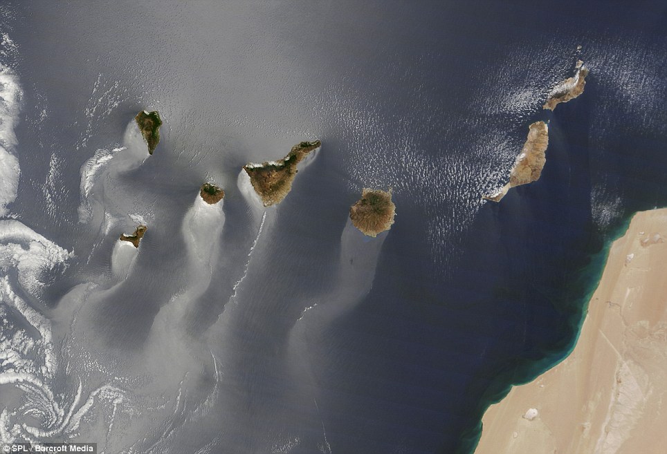
The Canary Islands are a Spanish archipelago located just off the northwest coast of mainland Africa, 100 km west of the border between Morocco and the Western Sahara

Fascinating images of the world's islands were taken from space. Hawaii looks like a goat's head

The coral islands of Australia taken in space look like jewels in the vast ocean